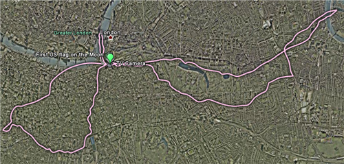
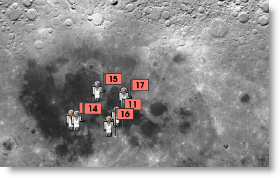
Looking at the moon landings on Earth might seem like a silly idea, but New Scientist have put together a collection of downloadable layers for Google Earth, which allow you to see how far the astronauts went on their moon explorations. They put the routes taken by the Apollo explorers, and add them to major cities. If you know any of the cities included – London, New York, Los Angeles, Boston and Sydney – these give you an excellent feel for the scale of their investigations, from the small first steps of Apollo 11, to the much larger distances covered in later missions with the Lunar Rover.
If moon landings on Earth are too earthy for you, check out Google’s 2D Moon here. Google are announcing “something special” at an event later today featuring none other than Buzz Aldrin. If they don’t announce Google Moon in 3D, I’ll eat my space suit.
In the unlikely event that the moon isn’t added to Google Earth, you can download NASA’s World Wind, which is free and features 3D models of Earth, the moon, Mars, Venus and Jupiter too.
Download the Google Earth moon landing layers here, and Google Earth here. If you have Google Earth installed, download the layers you want, and just open them with Google Earth. The moon landing images will then appear automatically.

